“Let’s all go for a nice walk in the Peak District.” someone piped up in a management meeting one day. And so the idea was born.
When it landed in the Co-Pop team’s calendars it was posted innocuously as ‘Company Day Out!’ and described verbally as ‘a day in the countryside with a few hours walking and a nice refreshing beer at the end.’ We were sold.
The split in the team was pretty clear as the train took us from Piccadilly to Glossop on the edge of the Peaks. The townies amongst us were fascinated and sceptical in equal measure as city and suburbs gave way to villages and rolling hills, while those with an affinity to the great outdoors visibly relaxed as the red brick turned to stone and the skies got bigger.
Another dead giveaway was the level of preparation members of the team had gone to with some of us in trainers, jeans & tee shirts and others head to toe in hiking gear, with sticks and long trusted walking boots.
Our first casualty occurred before we’d left Glossop station as Alyssa, our UX Designer, decanted a bottle of water into her rucksack, drenching everything. No matter, it could’ve been worse, a little water never hurt anyone. This was a sentiment we were all going to understand more personally a few hours hence but for now, we ambled on, blissfully unaware of what awaited us on the tops.
We took a brisk walk through old Glossop, up to Manor Park with its formal Victorian planning and miniature railway, and left town along the semi-industrial Shipley Street. Little did we know that this was to be the last vestige of civilisation we were to see for about eight hours, and had we known what lay ahead I suspect that some of the party would have chosen to stay in town.
Regardless we followed the path on its gentle upwards slope splitting into smaller groups and chatting about the topics of the day – the weather, walks we’d been on in the past, how impressive Dom’s dog Max was sprinting up and down the hills without a care in the world. There were a couple of tricky spots on the path where each chose the best way to navigate a stile or a brook, but all in all nothing too taxing. The sun shone in the sky and we had fresh air in our lungs.
Onwards and upwards the path steepened and became less definite. The group became more fragmented, separated by experience, quality of footwear, and level of enthusiasm as much as anything else. We experienced our first team whole-shoe-swallowing as Martin, our Lead Designer, underestimated the firmness of the ground and his foot disappeared for a short but significant split second. Who knew you could find swamps on steep hillsides?
Doctor's Gate
A short sharp shock of a hill at Doctor’s Gate took us up to the tops where the terrain appeared flatter, if somewhat wetter. We’d been walking for a couple of hours and Glossop was miles away. Still, ignorance, as they say, is bliss and had we known what was to come, some of us, I dare say, would have turned back then.
We marched on, grouping up again as we crossed the Snake Pass where we were promised a paved path and easy going.
“We’ll stop for lunch just over that hill,” Oisín Co-Pop’s Technical Lead and most enthusiastic hiker, promised, pointing ambiguously towards the horizon. We should have known then.
With the promise of cracking open our butties we set off along the path. It was indeed paved, though it’s fair to say that a reasonable number of the giant slabs were under a couple of inches of water. It was pretty easy going across the stunningly bleak moors and it gave us the opportunity to spend time with new people. We chattered about how the paving stones got there in the first place: do-gooders, prisoners, farmers; discussed house hunting, family, work and childhood. Our guiding light, the blonde Labradoodle Max, led the way, ever aware of just how far he was away from dad.
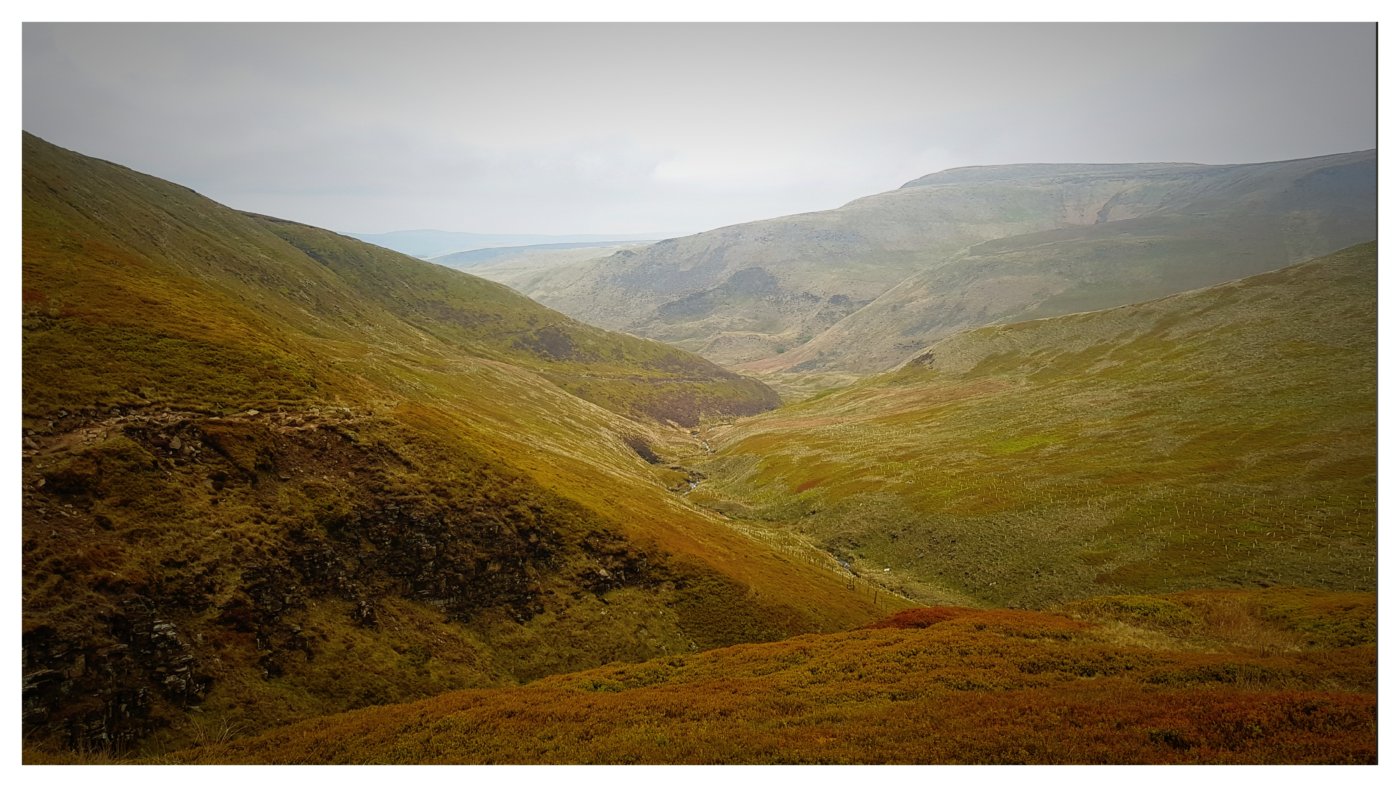
In due course we arrived at a large pile of rocks, a landmark and a definite change in direction on the Pennine Way. It turned out this wasn’t the lunch stop some of us had expected but all the same it afforded is some great views towards Kinder Scout and the surrounding moorland.
“Just over that hill,” Oisín pointed towards Kinder, “That’s where we’ll stop for lunch. It looks harder than it is, honest.”
Coming towards us, from the direction we were about to head in, a group of walkers with a knowing look in their collective eye. They had come from where we were headed and they knew. They knew what was in store for us naive walkers.
Down towards the base of Kinder Scout we trudged, the odd whinge here and there, and the occasional fell runner nodding a knowing look as we passed them. At the bottom we looked up at the path ahead, straight and rugged, deceiving. Co-Pop’s MD, Dom, led the way, on the hills as back at work, Caius, our XR Lead, and Oisín keeping him company. Others of us, more used to footpaths and city streets than craggy climbs, made slower progress. This was steep and difficult, required an element of support from each other and regular rest points to catch our breath. It was arguably the toughest part of the whole day. Reaching the top though was worth it. The sun shone down on us and the views across the Peaks and towards Manchester were breathtaking. We rested, regrouped and drank in the sights.
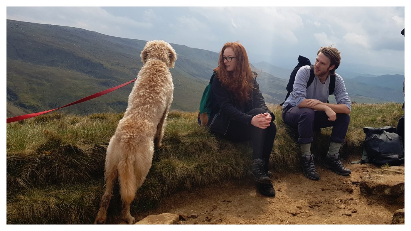
On Kinder Scout - Max, Alyssa and Mike
“So we’re going to stop for lunch just up there, over that hill,” it was Oisín with a cheeky grin and his latest piece of propaganda. It turned out that his method of motivation was to offer bite-sized challenges to make us feel like the goal was well deserved. A few threats and accusations in his direction later we marched on. The path took us higher still. It was considerably easier than the gradient we’d just tackled and littered with huge rock formations that looked like they’d been tossed there ten thousand years before by giants. The views were stunning and still there was no sign of civilisation.
We did eventually stop for lunch, up there on the tops. We hunkered down between boulders, on the edge of a ravine carved into the land by a waterfall just ahead, dug deep into our backpacks and retrieved our long lost but never forgotten lunches. Hot coffee, sandwiches, fruit and crisps were tucked into like we’d not eaten for weeks. The chance to recharge batteries up there in the wilderness, was not lost and once again the team became one.
“Have you seen that!” someone said, and we turned to see a storm which had been hovering over Stockport, coming towards us from miles away. Sure and steady, but fast, it was heading in our direction and we all knew what was going to happen. Lunch was rapidly finished and waterproofs came out.
Back on the path and ready, or so we thought, for a shower, we followed Dom’s lead. The path soon disappeared and we found ourselves following a shallow stream. The mud became deeper and wetter, the stream wider and more difficult to cross, and the banks steeper and trickier to find a foot hole as we navigated it along both sides. The weather descended. Within a few seconds we were in a cloud, everything was drenched and we couldn’t see more than a few metres ahead. The team contracted again in an effort to ensure nobody was left behind and those that needed a hand to pull, or a shoulder to lean, had one.
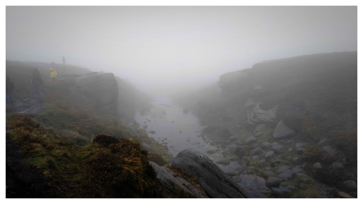
When the fog descended
Visibility was only a few metres and with no path or landmarks to speak of it all seemed pretty bleak up there however, when asked to give a score out of ten to indicate his confidence in our location Dom, after consulting his map, declared assuredly ‘Ten!’ and we marched on.
Everything, as they say, is temporary and as time went on, and the team made it out of the quagmire, the skies gradually cleared and footing became firmer. Bit by bit and one by one we unzipped, and eventually shed the waterproofs finding ourselves once again at the top of the world with the moors receding and rocky, hard ground under foot.
The Pennine Way was obvious again and there were even slabs of stone-paving again to guide our path. At a fork in the path Dom paused, took the right path and waited with Max, for the team to gather where the track stopped. The path came to an abrupt end and looked down over a deep and rocky gorge, whose course disappeared round a crook in the valley.
“Right everyone,” Dom announced, “We’re going down.”
And down we went.
It turned out that the journey down was equally as difficult as the journey up. While the weather was now on our side, the route again proved challenging with every step needing careful consideration and the physical effort of negotiating a path, especially after nearly six hours of cross country trekking, was grueling. Once more the group stretched as the more sure-footed amongst us led the way and other more cautious people chose the slow and steady option.
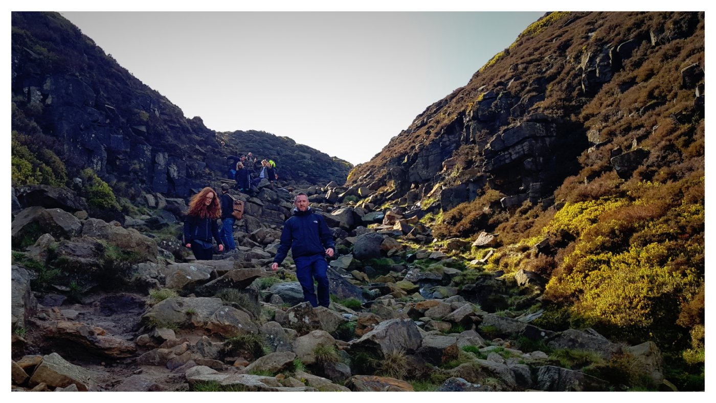
Edale descent
The tough, jagged valley eventually bottomed out and the path, once again surrounded by grassland, followed the stream towards our destination. Our first sign of humanity in hours, a gate with a stile, came into view. Before we knew it there were people too, walkers and fell runners, another dog, a family out for a late afternoon stroll.
The trail took us to a bridge, another sign of civilisation, and on the other side a small wooded area leading to a field occupied by sheep with their lambs. The relief was evident on everyone’s face as the path through the field led to the village of Edale and we piled into the pub.
Equipped with pints all round the team, as one again, began storytelling about their experiences since leaving Glossop nearly nine hours earlier. The climbs, the weather, the views and the sense of accomplishment in a job well done.